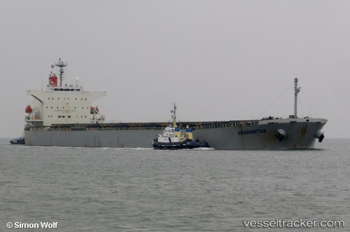
vessel BULK HALMAHERA IMO: 9310410, Bulk Carrier vesseltracker.com
Vessel BULK HALMAHERA IMO: 9310410, Bulk Carrier
MMSI: 538010155 callsign: V7A5689 size: x

Find the position of the vessel BULK HALMAHERA on the map. The latter are known coordinates and path.

marine traffic ship tracker show on live map

The current position of vessel BULK HALMAHERA is 0.01021 lat / 104.611 lng. Updated: 2025-02-07 12:58:04 UTC

Currently sailing under the flag of Marshall Islands

BULK HALMAHERA built in 2005 year

Deadweight:
76598 t

Details:


Last coordinates of the vessel:
2025-02-07 12:58:04 UTC, 0.01021, 104.611, course: 50, speed: 9.2

Track of the vessel in the last 14 days


Most frequent ports a vessels calls at BULK HALMAHERA (538010155):

Torres Strait, traffic: 3
Tsugaru-Kaikyo, traffic: 2
Wusong, traffic: 2
Astoria, traffic: 2
Yeosu, traffic: 2
Gladstone Harbor, traffic: 2
Yosu, traffic: 2
Port Headland, traffic: 2
Nansha, traffic: 2
Port Hedland, traffic: 2
Wu-Sung, traffic: 1
Newcastle, traffic: 1
Paradip, traffic: 1
Thursday Island, traffic: 1
Sambu, traffic: 1

Link to the map:


Find another ship

BULK_HALMAHERA (538010155) last ports (portcalls and passsages)

Yosu | 2022-08-14 10:24:44
Yosu | 2022-08-10 10:10:34
Newcastle | 2022-07-07 13:25:31
Torres Strait | 2022-06-20 22:19:22
Sambu | 2022-06-12 04:03:33
Paradip | 2022-06-04 02:05:28
Selat Lombok | 2022-04-07 12:28:13
Port Headland | 2022-04-02 15:10:11
Nansha | 2022-03-13 12:11:01
Astoria | 2022-02-16 12:40:20
Tsugaru-Kaikyo | 2022-01-27 10:46:06
Gladstone Harbor | 2022-01-02 22:10:56
Torres Strait | 2021-12-28 05:23:42
Wusong | 2021-12-09 20:40:26